The Loccum-Volkenroda pilgrimage trail conn. the former Cist. monasteries of Loccum and Volkenroda.
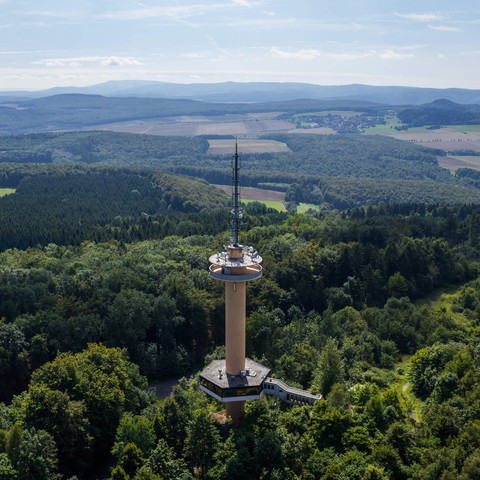
Near Bursfelde Monastery, the Nieme flows into the Weser. The pilgrimage trail runs through its narrow valley across the Dransfeld plateau to Hoher Hagen with the Gauss Tower, a prominent landmark of the region. An excursion leads from Loewenhagen to the cross stones in Bühren. South of Göttingen, the route passes Germany's first bioenergy village, the half-timbered village of Jühnde, to the former Mariengarten monastery. In the fertile Leine valley, the trail passes Klein-Schneen with its manor and the village of Friedland. East of Reiffenhausen, the pilgrimage trail leaves the Göttingen region again via the biotope of the Green Belt, the former death strip of the inner-German border, and reaches Thuringia and the Eichsfeld region. There are numerous monasteries and monastery ruins along the way, most of them of Cistercian origin. Together with other architectural monuments worth seeing, they bring to life a history of faith that has lasted for centuries. In addition, the former inner-German border is crossed. In this way, the happiness of the peaceful revolution of 1989 can also be experienced. Connections of the Loccum - Volkenroda pilgrimage trail in the Göttingen region Dransfeld - Göttingen Signposted with a green Cistercian cross The trail runs parallel to the B3 in the direction of Varmissen and Klein Wiershausen, unaffected by road noise, connects here with the cycle/footpath on the former Dransfeld-Göttingen railway line, circles Groß Ellershausen and leads behind the town cemetery towards the town centre to the Leine. At the Leine bridge on the B3, the path branches off to the railway station. Towards the town centre, the trail leads through the old town past the old town hall and ends at the church of St. Jacobi. Bühren - Hann. Münden Signposted with green Cistercian cross At the eastern end of Löwenhagen, the green signposted byway of the pilgrims' path leads via Varlosen to Bühren and ends there at the western edge of the village at the cross stones. From there, the Bühren - Hann. Münden connection is also signposted. The trail follows the hiking trail X4 in significant sections through the Bramwald forest, meets the village of Volkmarshausen and runs along the slopes of the Blümer Berg and Questenberg mountains to then reach Hann. Münden in the Blume district. Over the historic Werra sandstone bridge, the trail leads through the old town to St. Blasius Church and ends at the railway station.
Source: Göttinger Land leisure portal


