Well-preserved fortification above ground consisting of rampart and ditch, ground plan elongated oval, oriented NNO-SSW, length outside 320 m, width maximum 150 m, interior area 3.215 hectares.
The outer ground plan shows two long and parallel west and east flanks, a semi-circular curved north flank and a south flank set off by bastion-like bends. The total length of the rampart/ditch 760 m, the course is damaged in the north by older road construction, otherwise, there is only a forest road cut and several minor damages to the rampart.
Gates are recognisable in the centre of the southern flank as well as in the centre of each of the western and eastern flanks, another gate is located in the southeast; a northern gate remains questionable - due to the path construction damage - and is to be checked.
Flatly undulating interior, sloping from north to south by about 15 m, along the central axis, a ridge of sandstone rubble rises slightly, interspersed with quarry pits and funnels (probably medieval to early modern quarrying). Throughout the interior, there is evidence of anthropogenic settlement of large unworked sandstones, partly reconstructable as rectangular ground plan configurations and point foundations for 'floating' timber structures of former storage store buildings. After magnetometer prospection, there are indications of underground pit structures (cellars, cisterns, cesspools ?). These geophysical investigations in connection with find concentrations show a central building in the northern part of the camp.
Until November 2005, the complete surface prospection with the metal detector was carried out continuously, i.e. a fine-mapping with individual measurements and recovery of all metal objects in the near-surface soil layer 0 - 0.25 m depth (forest humus and bioturbation-disturbed upper sand-loess-stone debris cover).
From October 2003 to November 2005, several profile cuts were made through the rampart and ditch. Also, several surface exposures in the interior. The profile sections have shown: the rampart is randomly built up of sandy loess with large individual stone blocks, base width today 5 - 6 m, height still 0.8 - 1.2 m; on the outside runs a - largely filled - pointed ditch without a berm, upper width 3.5 - 4 m, depth 1 - 1.2 m. The ditch was probably reconstructed as a wood-loess ditch. Probably reconstructed as a timber-earth wall with a rampart embankment on the inside, with stone reinforcement of a former wooden weir on top. Total height from the base of the ditch to the top of the rampart about 3.5 - 4.5 m.
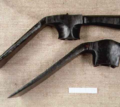
In profile section 12 (through the eastern flank), the old surface from the construction period is preserved as a fossil A horizon, on which the following finds were found: 1 iron pioneer axe (dolabra), pottery fragments of local make and Roman wheel ware (yellow- to red-toned, smoothed, thin-walled), charcoal.
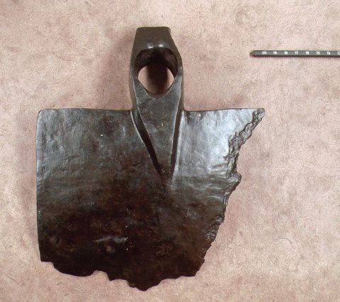
In the northeast section, a second iron pioneer's axe (dolabra) was recovered under the rampart core, a third in the southern rampart; a fourth dolabra was found in the rampart core in the north section during road construction as early as 1883. An iron shovel hoe was also found at the base of the rampart.


